
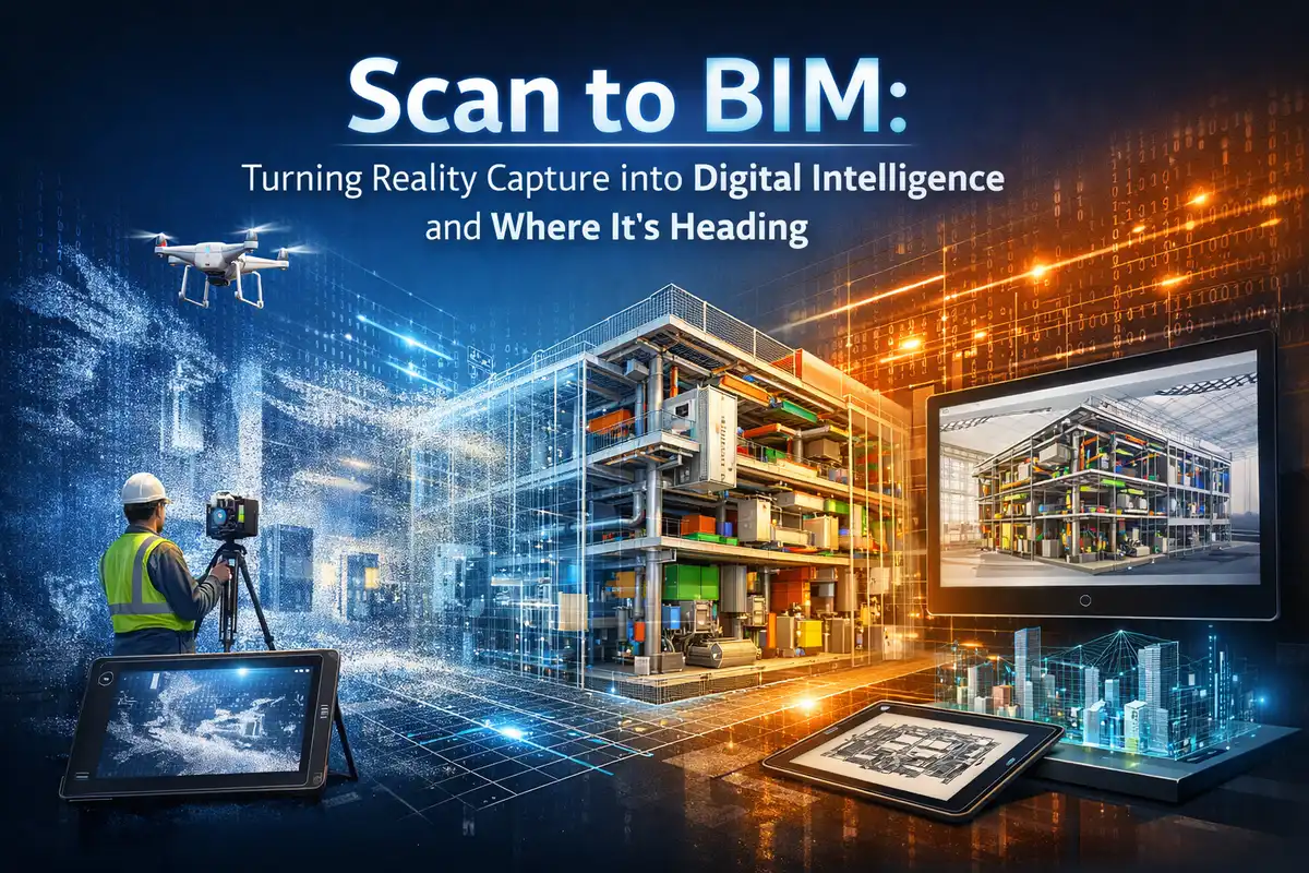
Turning Reality Capture into Digital Intelligence and Where It’s Heading
22 January 2026
Every design decision depends on one simple question: can the existing conditions be trusted. In many renovations and retrofit projects, the answer is uncertain. Drawings are often incomplete, revised over decades, or disconnected from what actually exists on site.
As reality capture becomes more common, architects and BIM teams now have access to highly accurate point cloud data. Yet raw scans alone do not solve coordination or documentation challenges.
Scan to BIM bridges this gap by converting reality capture into structured, usable building information. The process supports better design, reduces site dependency, and creates a shared reference for multi-disciplinary coordination when implemented strategically. This article explores how scan to BIM works in today’s construction practice and how its role is changing as people expect more accuracy, better standards, and increased long-term use of information.
What Scan to BIM really delivers
Scan to BIM converts reality capture data, most commonly terrestrial laser scans and mobile LiDAR, into structured building information models suitable for design, coordination, and documentation. At its core it is a quality assurance tool: it replaces uncertain or outdated drawings with measured geometry and metadata that teams can rely on for decisions.
Key benefits for architectural and BIM teams include:
- Accurate as-built records that reduce assumptions during design.
- Fewer site revisits because the point cloud preserves the project conditions for repeated review.
- Faster, more reliable coordination between disciplines when models reflect built constraints.
- Better documentation for refurbishment, heritage conservation, and MEP-heavy projects where existing conditions matter.
Typical use cases are refurbishment and fitout projects, heritage recording, technically complex MEP-infilled buildings, and large infrastructure retrofits where retrofit tolerances are tight. These are precisely the projects where a single missed measurement can cascade into costly rework.
Industry uptake is rising. A review of reality capture adoption cites studies reporting that 62% of construction firms have used laser scanning applications, underscoring that Scan to BIM is no longer experimental for many delivery teams.
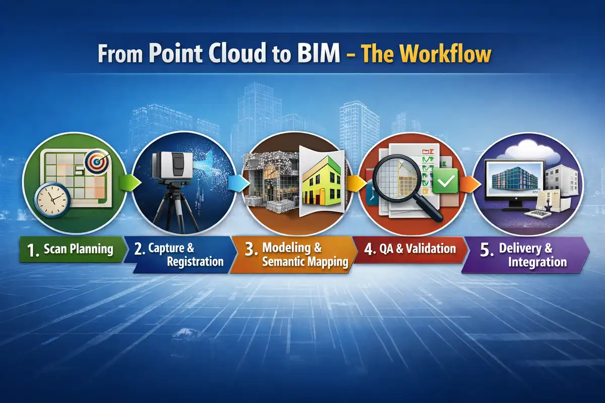
From Point Cloud to BIM – The Workflow
Scan to BIM Services is several linked processes rather than a single service. Treating it as a sequence with clear decision points keeps schedules and budgets predictable.
1. Scan planning
Effective deliveries begin before the scanner turns on. The planning stage sets scan locations, target accuracy, expected deliverables, and model scope. Decisions include how much of the building to model, which systems require parametric objects, and the target level of detail.
Practical items to define at this stage:
- Deliverable LOD and whether families or generic solids are required.
- Coordinate system, survey control procedure, and datum references.
- Photo capture requirements and any restricted-access windows.
- Turnaround time and file formats for point cloud and final model.
A clear scope here prevents scope creep later when modelers are asked to add detail that was not planned.
2. Capture and registration
Scanning teams capture raw point clouds and photos from multiple positions. The registration process aligns scan positions into a single, georeferenced point cloud. Accuracy checks against known survey control or benchmarks are important to confirm capture quality before modeling begins.
3. Modeling and semantic mapping
Modelers translate the point cloud into BIM geometry and attach necessary metadata. This is where scope matters. Modeling can be:
- Measured geometry only, where exact spatial constraints are required.
- Parametric families with metadata, where the model will feed coordination and schedules.
- Hybrid, using simplified solids for architectural shells and parametric families for systems that need coordination.
Modelers must balance fidelity with usability. Over-modeling every nut and bolt creates heavy files and slows downstream workflows. Under-modeling creates gaps that force later site checks.
4. QA and validation
Quality checks compare the model back against the point cloud. Common QA steps:
- Deviation color maps to highlight areas where the model differs from scan data.
- Tolerance checks for critical clearances, especially MEP routing spaces.
- Clash detection runs in coordination federations to ensure the as-built constraints are visible to coordination teams.
A signed QA report that documents tolerances, registration accuracy, and unresolved ambiguities is a useful contract artifact.
5. Delivery and integration
Final deliverables typically include the point cloud, the federated or discipline BIM files, a model use guide, and QA documentation. For handover, ensure the model’s coordinate system, naming conventions, and LOD notation match the design and construction workflows so the model is immediately usable in coordination and clash detection.
LOD and Scope Decisions, In Practice
Level of Development is often the most contentious part of Scan to BIM. Rather than debating academic LOD tables, decision makers should link LOD to use:
- For Coordination: Model existing ducts and pipes as simplified solids that represent space claims.
- For Fabrication or Retrofit Work: Use parametric families with measurable geometry and metadata.
- For Historic Documentation: Capture geometry to a higher fidelity and include photos and annotations.
A simple checklist to include in the scope document: Intended model use, allowed modeling tolerances, list of families that must be parametric, and explicit exclusions. This reduces ambiguity between surveyor, modeler, and architect.
Making Scan to BIM Work for Architecture Teams
Scan to BIM process succeeds when it is implemented into project workflows naturally, not shoehorned in as an afterthought.
Practical approaches that architects can adopt:
- Provide a concise technical brief to providers that states model uses, required coordinate system, and firm CAD/BIM standards.
- Ask for an initial deliverable sample from an early scan to validate assumptions about model weight and family usage.
- Require QA evidence: registration error statistics, deviation maps, and a short list of unresolved ambiguities.
- Plan review milestones in design schedules that use the point cloud model for decisions rather than deferring all checks to site fitouts.
When integrating Scan to BIM into coordination, treat the as-built model as a constraint. Use it in clash detection sessions early so routing choices reflect real conditions and reduce late-stage redesign.
Future Trends and What to Prepare For
Scan to BIM services are dependent on three clear axes: automation, standardization, and integration.
Automation and AI-assisted modelling
Machine learning tools are speeding up the process of segmentation and object recognition in point clouds. Semantic segmentation process can automate the extraction of floors, walls, and common fittings, which can reduce manual modeling time. You can expect the manual-to-automated ratio to shift in the next few years, with human interventions focusing on verification and complex geometry. The ongoing research on automation also stresses the need for human oversight for edge cases and tolerancing.
Clearer deliverable standards
Clients and architects will demand clearer definitions of what a Scan to BIM delivery includes. This means more explicit LOD descriptions tied to intended model use, standard naming conventions, and required QA artifacts. These standards will make procurement and acceptance more straightforward and reduce disputes.
Integration with construction monitoring and digital twins
Scan to BIM will increasingly link to construction monitoring, allowing periodic scans to track deviations during build and to feed digital twin platforms for facilities management. The market supporting reality capture hardware and services is expanding, reflecting growing demand for this linkage. Recent market analysis points to the fact that the value of terrestrial laser scanning technologies in the market is increasing, the market is expected to be worth USD 6.4 billion by 2033, and is going to show a growth of 5.9% per annum (CAGR) during 2025-2033, which is a sign of wider acceptance and investment.
Data management and long-term use
As models become assets for operations, clients will expect Scan to BIM deliveries that consider long-term data storage, naming, and how the model will be updated. Architects and facilities teams should include data governance clauses in briefs so the model remains trustworthy over time.
Practical Questions Architects Should Start Asking Providers Now
- What accuracy and registration tolerances will you deliver, and how are these verified?
- What is the recommended LOD for my intended use, and which elements will be parametric versus simplified solids?
- How will the model be organized, named, and handed over for immediate use in our coordination platform?
- What QA artifacts will accompany the model and how are ambiguities recorded?
- How do you manage large point cloud datasets and what are the recommended file formats and workflows for our BIM environment?
Answering these questions before work begins reduces downstream friction and preserves schedule certainty.
Conclusion
Scan to BIM moves reality capture from a data-gathering exercise into digital intelligence that architects can trust for design and coordination. Its practical value is now visible on projects with complex MEP, sensitive tolerances, and heritage constraints.
With automation, clearer deliverable standards, and closer ties to construction monitoring, Scan to BIM has become an inseparable part of construction practices.
With the growing complexity of construction projects and higher client expectations for delivery projects on time, decision makers of AEC firms should consider Scan to BIM as a workflow decision. Start by defining model use and acceptance criteria, ask for QA artifacts, and plan for data governance. For those who want a quick next step, watch a Scan to BIM model walkthrough to see how point cloud, model, and QA artifacts map into coordination workflows.
Working with a skilled professional allows homeowners to maximize the potential of their outdoor areas. Customization, maintenance advice, and long-term durability are key advantages. Choosing a premium expert is a practical and worthwhile step for any property owner seeking excellence in outdoor living.
Comments on this guide to How scan to BIM services turn point clouds into BIM Intelligence article are welcome.
BIM
Overcome airport construction complexities with BIM

BIM: Building Information Modelling
BIM Objects and Building Products: Computer Design
Macro BIM: Building Information Modelling
++
Revit
AutoCAD and Revit transform the construction industry
Use Cases of Revit in Architecture
+++
Home Articles
Architecture
Comments / photos for the How scan to BIM services turn point clouds into BIM Intelligence – Turning Reality Capture into Digital Intelligence and Where It’s Heading page welcome.